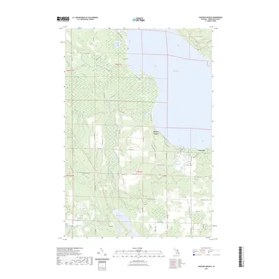
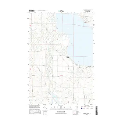
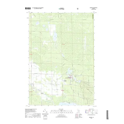
2023 Map of Hangore Heights
USGS Topo · Published 2023About this map
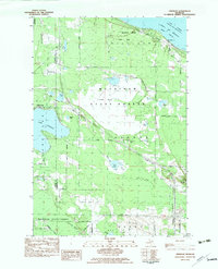
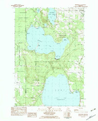
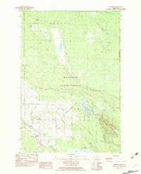
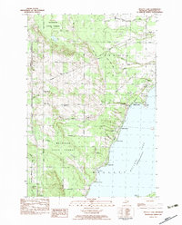
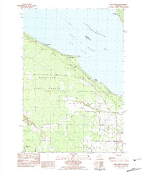
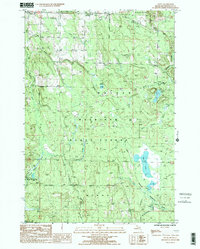
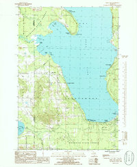
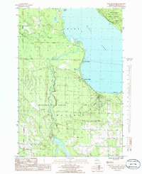
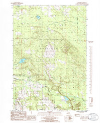
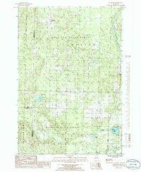
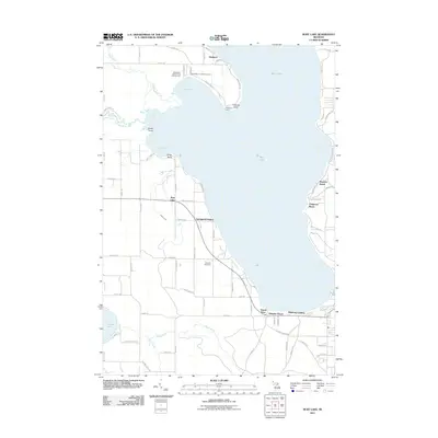
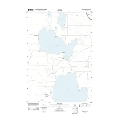
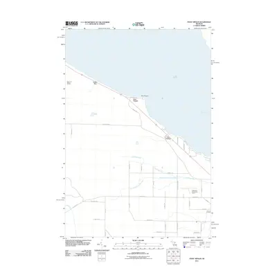
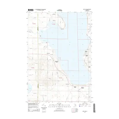
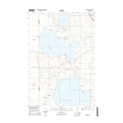
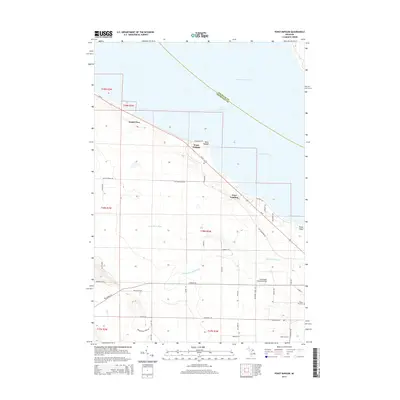
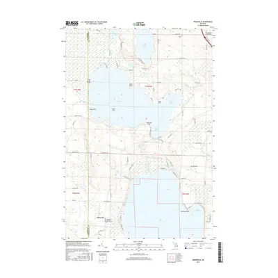
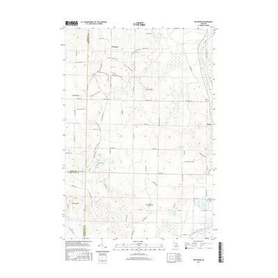
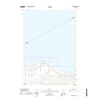
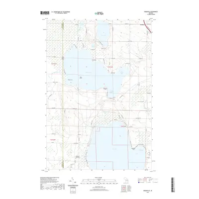
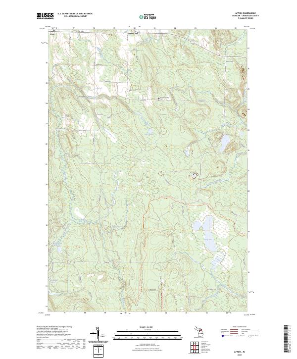
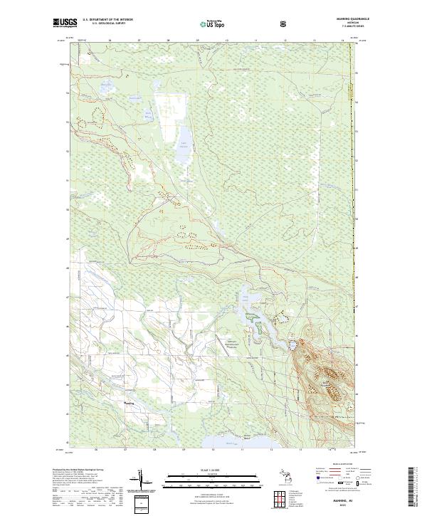
Black Lake dominates the eastern edge of this northern Michigan landscape, providing a clear shoreline reference for the Hangore Heights community and nearby Black Lake settlement. The interior is defined by an intricate network of wetlands and water bodies, including Kleber Pond, Mud Lake, and the winding Black River. These waterways are connected by a dense grid of local roads and recreational paths such as the North Eastern State Trl and Red Bridge Trl. For those researching local history, the map identifies specific landmarks like Waverly Cem and the unique Reuther's Graves site located near Fisher Creek. The southern reach of the survey is marked by the convergence of Milligan Creek and Stony Creek, highlighting the diverse riparian environments that characterize this portion of Cheboygan County.
Find a feature on this map
65 named features on this map. Tap any name to fly to it.
Don’t see what you’re looking for? This feature index may not catch every label — zoom into the map to look around manually.
Map Details
Editions of this 2023 Hangore Heights Map
This is the sole edition of this map. No revisions or reprints were ever made.
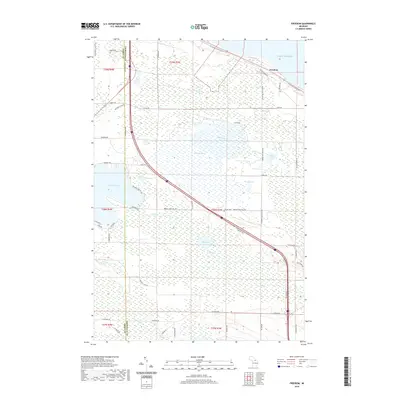
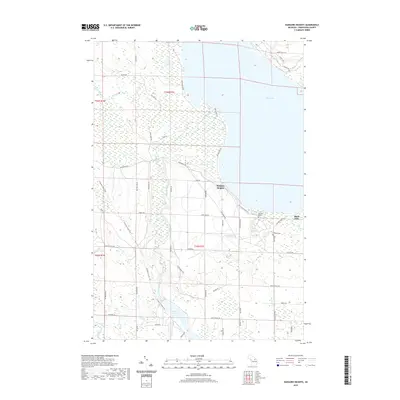
Historical Maps of Waverly Township Through Time
73 maps found
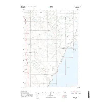
1957 Mullett Lake
Cheboygan County, MI
1982 Aloha
Cheboygan County, MI
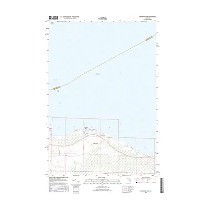
1982 Cordwood Point
Cheboygan County, MI
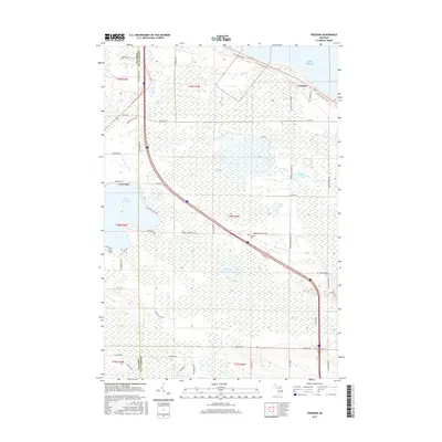
1982 Freedom
Cheboygan County, MI
1982 Indianville
Cheboygan County, MI
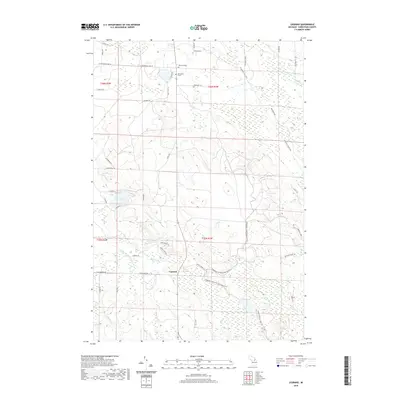
1982 Manning
Cheboygan County, MI
1982 Mullett Lake
Cheboygan County, MI
1982 Point Nipigon
Cheboygan County, MI
1986 Afton
Cheboygan County, MI
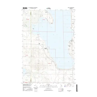
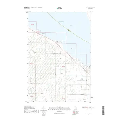
1986 Burt Lake
Cheboygan County, MI
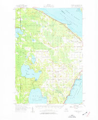
1986 Hangore Heights
Cheboygan County, MI
1986 Legrand
Cheboygan County, MI
1986 Wildwood
Cheboygan County, MI
2011 Afton
Cheboygan County, MI
2011 Aloha
Cheboygan County, MI
2011 Burt Lake
Cheboygan County, MI
2011 Cordwood Point
Cheboygan County, MI
2011 Freedom
Cheboygan County, MI
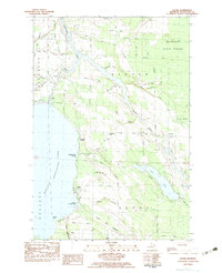
2011 Hangore Heights
Cheboygan County, MI
2011 Indianville
Cheboygan County, MI
2011 Legrand
Cheboygan County, MI
2011 Manning
Cheboygan County, MI
2011 Mullett Lake
Cheboygan County, MI
2011 Point Nipigon
Cheboygan County, MI
2011 Wildwood
Cheboygan County, MI
2014 Afton
Cheboygan County, MI
2014 Aloha
Cheboygan County, MI
2014 Burt Lake
Cheboygan County, MI
2014 Cordwood Point
Cheboygan County, MI
2014 Freedom
Cheboygan County, MI
2014 Hangore Heights
Cheboygan County, MI
2014 Indianville
Cheboygan County, MI
2014 Legrand
Cheboygan County, MI
2014 Manning
Cheboygan County, MI
2014 Mullett Lake
Cheboygan County, MI
2014 Point Nipigon
Cheboygan County, MI
2014 Wildwood
Cheboygan County, MI
2017 Afton
Cheboygan County, MI
2017 Aloha
Cheboygan County, MI
2017 Burt Lake
Cheboygan County, MI
2017 Cordwood Point
Cheboygan County, MI
2017 Freedom
Cheboygan County, MI
2017 Hangore Heights
Cheboygan County, MI
2017 Indianville
Cheboygan County, MI
2017 Legrand
Cheboygan County, MI

2017 Manning
Cheboygan County, MI
2017 Mullett Lake
Cheboygan County, MI
2017 Point Nipigon
Cheboygan County, MI
2017 Wildwood
Cheboygan County, MI
2019 Afton
Cheboygan County, MI
2019 Aloha
Cheboygan County, MI
2019 Burt Lake
Cheboygan County, MI
2019 Cordwood Point
Cheboygan County, MI
2019 Freedom
Cheboygan County, MI
2019 Hangore Heights
Cheboygan County, MI
2019 Indianville
Cheboygan County, MI
2019 Legrand
Cheboygan County, MI
2019 Manning
Cheboygan County, MI
2019 Mullett Lake
Cheboygan County, MI
2019 Point Nipigon
Cheboygan County, MI
2019 Wildwood
Cheboygan County, MI
2023 Afton
Cheboygan County, MI
2023 Aloha
Cheboygan County, MI
2023 Burt Lake
Cheboygan County, MI
2023 Cordwood Point
Cheboygan County, MI
2023 Freedom
Cheboygan County, MI
2023 Hangore Heights
Cheboygan County, MI
2023 Indianville
Cheboygan County, MI
2023 Legrand
Cheboygan County, MI
2023 Manning
Cheboygan County, MI
2023 Mullett Lake
Cheboygan County, MI
2023 Point Nipigon
Cheboygan County, MI
2023 Wildwood
Cheboygan County, MI
Featured Locations
- Grant Township, MI
- Aloha Township, MI
- Waverly Township, MI
- Hangore Heights, Waverly Township
- Pine Grove Beach, Waverly Township