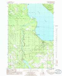
1986 Map of Hangore Heights
USGS Topo · Published 1986About this map
The western shoreline of Black Lake and the winding course of the Upper Black River dominate this Cheboygan County landscape. This mid-1980s provisional study details the developed waterfronts of Pine Grove Beach and Hangore Heights, where the lake meets the extensive woods of the Mackinaw State Forest. To the south, the village of Milligan sits near the confluence of Milligan Creek and the river, while the Michigan Grade provides a clear transport corridor through the timberland.
Find a feature on this map
27 named features on this map. Tap any name to fly to it.
Don’t see what you’re looking for? This feature index may not catch every label — zoom into the map to look around manually.
Map Details
Editions of this 1986 Hangore Heights Map
This is the sole edition of this map. No revisions or reprints were ever made.
Other maps of this area

1955 · Cheboygan
USGS Topo · 1:250,000

1957 · Tower
USGS Topo · 1:62,500

1957 · Cheboygan
USGS Topo · 1:62,500

1957 · Onaway
USGS Topo · 1:62,500

1958 · Cheboygan
USGS Topo · 1:250,000

1958 · Grace
USGS Topo · 1:62,500

1982 · Petoskey
USGS Topo · 1:100,000

1982 · Grace
USGS Topo · 1:24,000

1982 · Aloha
USGS Topo · 1:25,000
1982 · Manning
USGS Topo · 1:25,000