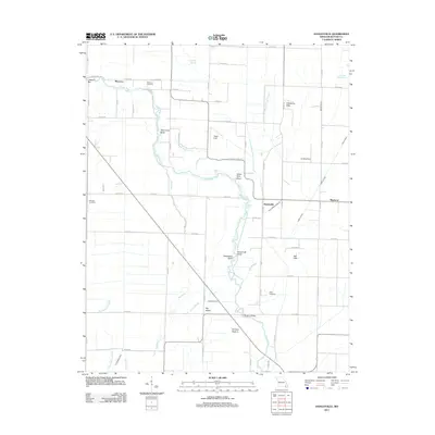
2011 Map of Hanleyville
USGS Topo · Published 2011About this map
The Black River winds through the heart of this landscape, carving out distinctive riverine features such as Hammons Bend, Grape Vine Bend, and Buttermilk Bend. This 2011 survey of the Missouri-Butler County border highlights a region defined by its complex drainage network, where the river interacts with numerous sloughs like Caney Slough, Catherine Slough, and Blue Spring Slough. Small agricultural settlements and family landmarks anchor the terrain, including Morocco in the northwest and Mayberry to the east. Genealogists will find significant value in the documentation of several local burial grounds, specifically Morocco Cemetery, Ashcraft Cemetery, and Hillis Cemetery. The eastern portion of the map rises into the Caledonia Hills and Ash Hills, providing a clear contrast to the low-lying river bottoms and the large landform known as Big Island situated near the crossing at Hargove Bridge.
Find a feature on this map
72 named features on this map. Tap any name to fly to it.
Don’t see what you’re looking for? This feature index may not catch every label — zoom into the map to look around manually.
Map Details
Editions of this 2011 Hanleyville Map
This is the sole edition of this map. No revisions or reprints were ever made.
Other maps of this area

1934 · Puxico
USGS Topo · 1:62,500

1935 · Poplar Bluff
USGS Topo · 1:62,500

1935 · Harviell
USGS Topo · 1:62,500

1939 · Puxico
USGS Topo · 1:62,500

1939 · Poplar Bluff
USGS Topo · 1:62,500

1940 · Valley Ridge
USGS Topo · 1:62,500

1949 · Poplar Bluff
USGS Topo · 1:62,500

1956 · Valley Ridge
USGS Topo · 1:62,500

1957 · Poplar Bluff
USGS Topo · 1:250,000

1959 · Poplar Bluff
USGS Topo · 1:250,000