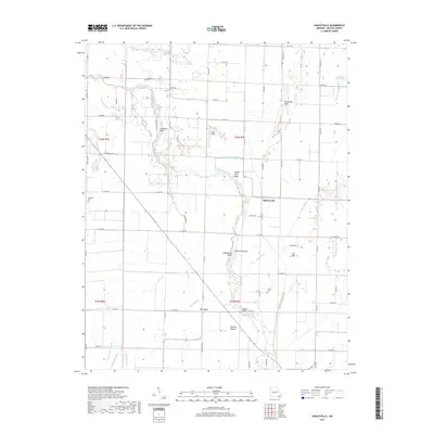
2017 Map of Hanleyville
USGS Topo · Published 2017About this map
The Black River snakes through the bottomlands of Butler County, Missouri, creating a complex geography of oxbows and secondary waterways. This alluvial landscape is defined by its numerous sloughs and bends, such as Hammons Bend, Catherine Slough, and Buttermilk Bend. The settlement of Hanleyville occupies a central position near the river's path, while the small community of Morocco is situated to the northwest. This area exhibits the classic hydrologic patterns of the Missouri Bootheel region, where drainage infrastructure like Ackerman Ditch and Snyder Ditch works alongside natural features like Caney Slough to manage the wet lowlands.
Find a feature on this map
78 named features on this map. Tap any name to fly to it.
Don’t see what you’re looking for? This feature index may not catch every label — zoom into the map to look around manually.
Map Details
Editions of this 2017 Hanleyville Map
This is the sole edition of this map. No revisions or reprints were ever made.
Other maps of this area

1934 · Puxico
USGS Topo · 1:62,500

1935 · Poplar Bluff
USGS Topo · 1:62,500

1935 · Harviell
USGS Topo · 1:62,500

1939 · Puxico
USGS Topo · 1:62,500

1939 · Poplar Bluff
USGS Topo · 1:62,500

1940 · Valley Ridge
USGS Topo · 1:62,500

1949 · Poplar Bluff
USGS Topo · 1:62,500

1956 · Valley Ridge
USGS Topo · 1:62,500

1957 · Poplar Bluff
USGS Topo · 1:250,000

1959 · Poplar Bluff
USGS Topo · 1:250,000