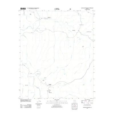
2011 Map of Hannagan Meadow
USGS Topo · Published 2011About this map
Hannagan Meadow and the small settlement of Cleaveland center this portion of Greenlee County, characterized by a complex network of high-elevation drainages and forest service outposts. The landscape is defined by the headwaters of the Black River and the meandering paths of Beaver Creek and Willow Creek. This 2011 survey captures the area's transition between grazing and recreational use, documented by numerous livestock watering sites like West Becker Tank and Bardman Tank alongside established forest infrastructure. The map provides clear evidence of the historical footprint of ranching and forestry through features like Balke Cabin and the Hannagan Forest Service Facility. Topographically, the area is deeply incised by canyons including Johns Canyon, Bardman Canyon, and Hawks Nest Canyon, which dictate the local road network comprising Co RD 24 and Co RD 26.
Find a feature on this map
69 named features on this map. Tap any name to fly to it.
Don’t see what you’re looking for? This feature index may not catch every label — zoom into the map to look around manually.
Map Details
Editions of this 2011 Hannagan Meadow Map
This is the sole edition of this map. No revisions or reprints were ever made.
Other maps of this area

1922 · Nutrioso
USGS Topo · 1:125,000

1954 · Clifton
USGS Topo · 1:250,000

1957 · Clifton
USGS Topo · 1:250,000

1958 · Clifton
USGS Topo · 1:250,000

1958 · Alpine
USGS Topo · 1:62,500

1958 · Hannagan Meadow
USGS Topo · 1:62,500

1958 · Big Lake
USGS Topo · 1:62,500

1961 · Blue
USGS Topo · 1:62,500

1962 · Clifton
USGS Topo · 1:250,000
1981 · Nutrioso
USGS Topo · 1:100,000