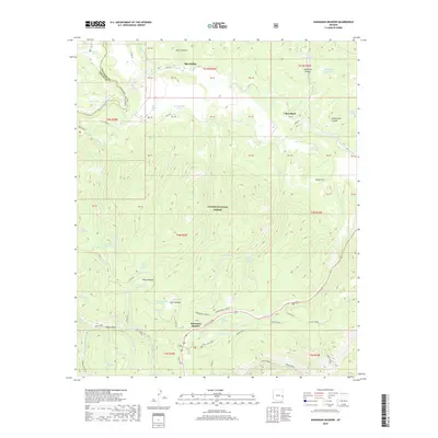
2018 Map of Hannagan Meadow
USGS Topo · Published 2018About this map
Hannagan Meadow and Sprucedale anchor this high-altitude landscape within the Apache National Forest, where the transition from alpine meadows to dense drainages is marked by a sophisticated network of water resources. The map details an environment defined by its hydrological features, from the flowing Black River in the northwest to various tanks and seeps like Hoot Owl Tank and Triangle Seeps that supported local ranching or forest management. The presence of named points such as Cleaveland and the winding Clell Lee Loop road suggests a history of forest habitation and recreation. The terrain is deeply incised by canyons like Hawks Nest Canyon and Bardman Canyon, with numerous springs such as Willow Spring and Clell Spring feeding the larger systems of Foote Creek and Grant Creek.
Find a feature on this map
90 named features on this map. Tap any name to fly to it.
Don’t see what you’re looking for? This feature index may not catch every label — zoom into the map to look around manually.
Map Details
Editions of this 2018 Hannagan Meadow Map
This is the sole edition of this map. No revisions or reprints were ever made.
Other maps of this area

1922 · Nutrioso
USGS Topo · 1:125,000

1954 · Clifton
USGS Topo · 1:250,000

1957 · Clifton
USGS Topo · 1:250,000

1958 · Clifton
USGS Topo · 1:250,000

1958 · Alpine
USGS Topo · 1:62,500

1958 · Hannagan Meadow
USGS Topo · 1:62,500

1958 · Big Lake
USGS Topo · 1:62,500

1961 · Blue
USGS Topo · 1:62,500

1962 · Clifton
USGS Topo · 1:250,000
1981 · Nutrioso
USGS Topo · 1:100,000