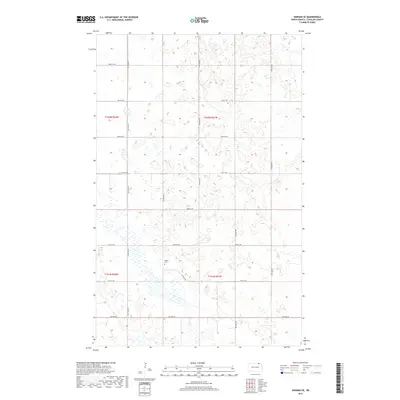
2017 Map of Hannah SE
USGS Topo · Published 2017About this map
Pothole wetlands and seasonal water bodies dominate this Cavalier County landscape, illustrating the glaciated terrain of the northern prairie. The grid of section lines and gravel roads, such as 100th St NE and 95th Ave NE, organizes the sparsely populated agricultural region near the Canadian border. A significant landmark for genealogical research is Bethel Cem, located in the southwest quadrant near the intersection of 95th Ave NE and 94th St NE. This survey shows the area's transition into the modern era, with a refined network of rural routes including 9th Ave W providing access across the township boundaries of t162n r62w and t162n r61w.
Find a feature on this map
18 named features on this map. Tap any name to fly to it.
Don’t see what you’re looking for? This feature index may not catch every label — zoom into the map to look around manually.
Map Details
Editions of this 2017 Hannah SE Map
This is the sole edition of this map. No revisions or reprints were ever made.
Other maps of this area

1953 · Devils Lake
USGS Topo · 1:250,000

1956 · Devils Lake
USGS Topo · 1:250,000

1970 · Alsen
USGS Topo · 1:24,000

1970 · Mount Carmel
USGS Topo · 1:24,000

1970 · Hannah SW
USGS Topo · 1:24,000

1970 · Wales
USGS Topo · 1:24,000

1970 · Hannah
USGS Topo · 1:24,000

1970 · Loma
USGS Topo · 1:24,000

1970 · Hannah SE
USGS Topo · 1:24,000

1970 · Langdon West
USGS Topo · 1:24,000