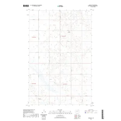
2020 Map of Hannah SE
USGS Topo · Published 2020About this map
The prairie landscape of Cavalier County is defined by its meticulous grid system and scattered rural landmarks. This corner of North Dakota, surveyed as townships t162n r61w, t162n r62w, t161n r61w, and t161n r62w, reflects a legacy of agricultural settlement and religious community. The presence of North Unity Mennonite Cem, Saint Johns Lutheran Cem, and Bethel Cem suggests a history of tight-knit congregational life that anchored these rural sections. A network of secondary roads, such as 95th Ave NE and 9th Ave W, provides the primary structure for the region's topography, which is characterized by numerous small depressions and prairie wetlands. These features demonstrate the enduring rural character of the northern Red River Valley periphery.
Find a feature on this map
20 named features on this map. Tap any name to fly to it.
Don’t see what you’re looking for? This feature index may not catch every label — zoom into the map to look around manually.
Map Details
Editions of this 2020 Hannah SE Map
This is the sole edition of this map. No revisions or reprints were ever made.
Other maps of this area

1953 · Devils Lake
USGS Topo · 1:250,000

1956 · Devils Lake
USGS Topo · 1:250,000

1970 · Alsen
USGS Topo · 1:24,000

1970 · Mount Carmel
USGS Topo · 1:24,000

1970 · Hannah SW
USGS Topo · 1:24,000

1970 · Wales
USGS Topo · 1:24,000

1970 · Hannah
USGS Topo · 1:24,000

1970 · Loma
USGS Topo · 1:24,000

1970 · Hannah SE
USGS Topo · 1:24,000

1970 · Langdon West
USGS Topo · 1:24,000