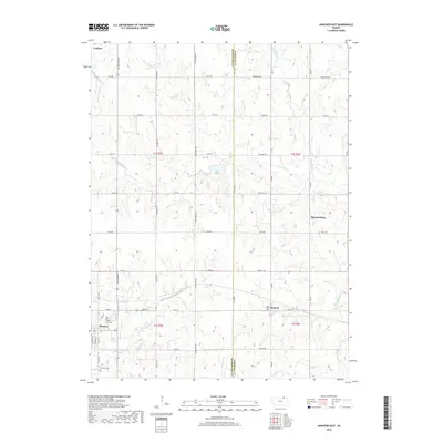
2018 Map of Hanover East
USGS Topo · Published 2018About this map
Hanover and Bremen anchor the southern landscape of this northern Kansas survey, where the winding course of Cottonwood Cr defines the local drainage. The area is marked by a legacy of early settlement and community, evidenced by Saint John's Cem and Hanover Cem. A distinct north-south divide follows the Washington Co and Marshall Co line, which bisects the quadrangle along Co Line Rd. This boundary separates a complex network of rural roads, including named routes like All-American Rd and Cross Creek Rd. In the north, the small community of Lanham sits near the Nebraska border, while Hermansberg occupies the eastern reaches. The terrain is deeply carved by numerous waterways such as Horseshoe Cr, Mountain Cr, and Little Indian Cr, illustrating the agrarian character and topographic relief of the region.
Find a feature on this map
45 named features on this map. Tap any name to fly to it.
Don’t see what you’re looking for? This feature index may not catch every label — zoom into the map to look around manually.
Map Details
Editions of this 2018 Hanover East Map
This is the sole edition of this map. No revisions or reprints were ever made.
Other maps of this area

1889 · Marysville
USGS Topo · 1:125,000

1894 · Marysville
USGS Topo · 1:125,000

1955 · Manhattan
USGS Topo · 1:250,000

1955 · Lincoln
USGS Topo · 1:250,000

1956 · Manhattan
USGS Topo · 1:250,000

1957 · Manhattan
USGS Topo · 1:250,000

1957 · Lincoln
USGS Topo · 1:250,000

1958 · Lincoln
USGS Topo · 1:250,000

1966 · Marysville
USGS Topo · 1:24,000

1966 · Hanover SE
USGS Topo · 1:24,000