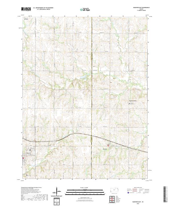
2022 Map of Hanover East
USGS Topo · Published 2022About this map
Hanover and Bremen anchor the southern landscape of this modern Kansas survey, situated along the county line between Washington and Marshall counties. The agricultural grid is well-defined by a network of rural roads including All American Rd and Cross Creek Rd, which traverse a terrain shaped by winding waterways. Notable drainage systems like Cottonwood Creek and Horseshoe Creek carve through the rolling sections of the quadrangle. For genealogists, the map preserves the locations of several community burial grounds, such as Saint Johns Cem near the town center and Immanuel Lutheran Cem further east in Hermansberg. Small rural settlements like Lanham remain mapped at the northern edge, illustrating the enduring settlement patterns of this central plains region.
Find a feature on this map
47 named features on this map. Tap any name to fly to it.
Don’t see what you’re looking for? This feature index may not catch every label — zoom into the map to look around manually.
Map Details
Editions of this 2022 Hanover East Map
This is the sole edition of this map. No revisions or reprints were ever made.
Other maps of this area

1889 · Marysville
USGS Topo · 1:125,000

1894 · Marysville
USGS Topo · 1:125,000

1955 · Manhattan
USGS Topo · 1:250,000

1955 · Lincoln
USGS Topo · 1:250,000

1956 · Manhattan
USGS Topo · 1:250,000

1957 · Manhattan
USGS Topo · 1:250,000

1957 · Lincoln
USGS Topo · 1:250,000

1958 · Lincoln
USGS Topo · 1:250,000

1966 · Marysville
USGS Topo · 1:24,000

1966 · Hanover SE
USGS Topo · 1:24,000