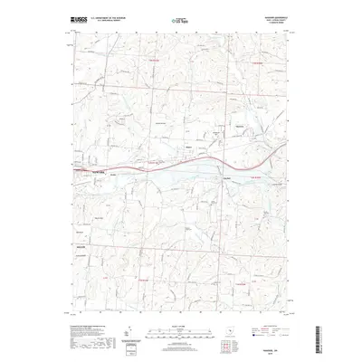
2019 Map of Hanover
USGS Topo · Published 2019About this map
The Licking River corridor east of Newark serves as the primary axis of this 2019 survey, where the waterway carves through the notable Licking Gorge. Small settlements such as Hanover, Marne, and Claylick are situated along the valley floor and lower slopes, connected by a network of historic routes including Licking Valley Rd. The terrain is defined by significant elevations like Coshocton Hill, Bucks Knob, and Coffman Knob, which rise above the drainages of Bowling Green Run and Claylick Cr. Genealogists and local historians will find several well-placed burial grounds throughout the townships, including Spring Grove Cem, Pleasant Chapel Cem, and Oakhill Cem. This map illustrates the modern footprint of Licking County as it balances its river-bottom agricultural roots with the expansion of the Heath and Newark urban fringes.
Find a feature on this map
119 named features on this map. Tap any name to fly to it.
Don’t see what you’re looking for? This feature index may not catch every label — zoom into the map to look around manually.
Map Details
Editions of this 2019 Hanover Map
This is the sole edition of this map. No revisions or reprints were ever made.
Other maps of this area

1909 · Newark
USGS Topo · 1:62,500

1909 · Thornville
USGS Topo · 1:62,500

1910 · Frazeysburg
USGS Topo · 1:62,500

1910 · Zanesville
USGS Topo · 1:62,500

1947 · Columbus
USGS Topo · 1:250,000

1950 · Marion
USGS Topo · 1:250,000

1961 · Columbus
USGS Topo · 1:250,000

1961 · Hanover
USGS Topo · 1:24,000

1961 · Newark
USGS Topo · 1:24,000
1961 · Thornville
USGS Topo · 1:24,000