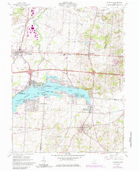
1961 Map of Thornville
USGS Topo · Published 1962About this map
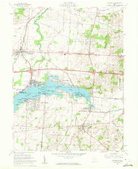
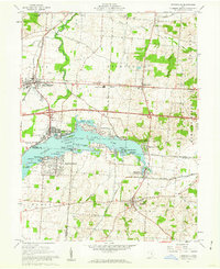
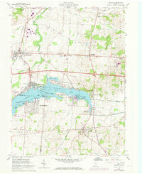
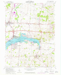
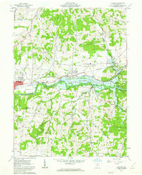
Buckeye Lake State Park dominates the center of this landscape, its waters dotted with numerous named landforms including Cranberry Marsh, Brundage Island, and Gibson Island. The surrounding shoreline shows a transition from recreational use at Harbor Hills and Edgewater Beach to established residential pockets like Fairfield Beach. Historically, the area is defined by the Refugee Lands Line, a significant surveying boundary cutting through the townships of Licking, Thorn, and Walnut.
Find a feature on this map
65 named features on this map. Tap any name to fly to it.
Don’t see what you’re looking for? This feature index may not catch every label — zoom into the map to look around manually.
Map Details
Editions of this 1961 Thornville Map
5 editions found
Other maps of this area
1907 · Thurston
USGS Topo · 1:62,500
1908 · Granville
USGS Topo · 1:62,500
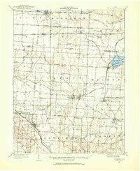
1909 · Newark
USGS Topo · 1:62,500
1909 · Thornville
USGS Topo · 1:62,500
1909 · Thurston
USGS Topo · 1:62,500

1910 · Granville
USGS Topo · 1:62,500

1947 · Columbus
USGS Topo · 1:250,000

1950 · Marion
USGS Topo · 1:250,000

1961 · Columbus
USGS Topo · 1:250,000
1961 · Hanover
USGS Topo · 1:24,000