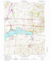
1961 Map of Thornville
USGS Topo · Published 1985About this map
Buckeye Lake dominates this central Ohio landscape, serving as a focal point for recreation and natural conservation in the early 1960s. The map illustrates the specialized environment of the Cranberry Bog Nature Preserve and the extensive Buckeye Lake State Park, which encompasses numerous named islands such as Journal Island, Custers Point, and Brundage Island. This era captures the transition of the shoreline from seasonal leisure to more permanent residential footprints at Fairfield Beach and Harbor Hills.
Find a feature on this map
66 named features on this map. Tap any name to fly to it.
Don’t see what you’re looking for? This feature index may not catch every label — zoom into the map to look around manually.
Map Details
Editions of this 1961 Thornville Map
5 editions found

Other maps of this area

1907 · Thurston
USGS Topo · 1:62,500

1908 · Granville
USGS Topo · 1:62,500

1909 · Newark
USGS Topo · 1:62,500

1909 · Thornville
USGS Topo · 1:62,500

1909 · Thurston
USGS Topo · 1:62,500

1910 · Granville
USGS Topo · 1:62,500

1947 · Columbus
USGS Topo · 1:250,000

1950 · Marion
USGS Topo · 1:250,000

1961 · Columbus
USGS Topo · 1:250,000

1961 · Hanover
USGS Topo · 1:24,000