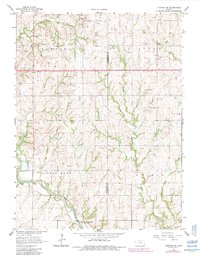
1966 Map of Hanover SE
USGS Topo · Published 1983About this map
Little Blue River and its numerous tributaries dominate this Kansas landscape along the border of Washington and Marshall counties. Surveyed in the mid-1960s with updates from 1981, the map reveals a deeply etched drainage pattern consisting of Knedlik, Bolting, and Walnut creeks feeding into the main river channel. This network of waterways dictated the placement of rural landmarks, such as the Gaging Station located near the mouth of Malone Creek.
Find a feature on this map
19 named features on this map. Tap any name to fly to it.
Don’t see what you’re looking for? This feature index may not catch every label — zoom into the map to look around manually.
Map Details
Editions of this 1966 Hanover SE Map
2 editions found
Other maps of this area

1889 · Marysville
USGS Topo · 1:125,000

1894 · Marysville
USGS Topo · 1:125,000

1955 · Manhattan
USGS Topo · 1:250,000

1956 · Manhattan
USGS Topo · 1:250,000

1957 · Manhattan
USGS Topo · 1:250,000

1966 · Marysville
USGS Topo · 1:24,000

1966 · Hanover SE
USGS Topo · 1:24,000

1966 · Hanover SW
USGS Topo · 1:24,000
1966 · Herkimer
USGS Topo · 1:24,000
1966 · Hanover West
USGS Topo · 1:24,000