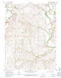
1966 Map of Hanover SW
USGS Topo · Published 1983About this map
Little Blue River winds through the heart of Washington County, Kansas, defining the physical and social boundaries between the townships of Hanover, Charleston, and Logan. The landscape is a study in mid-century Midwestern agriculture and transit, where the Burlington Northern and Missouri Pacific railroad lines track alongside the winding waterways. Deeply rooted community life is visible in the placement of the Townhall and the small cemeteries that serve the surrounding farmsteads, including St Paul Cem and Mount James Cem. While the terrain is shaped by many tributaries like Mill Creek and Beaver Creek, industrial activity is localized at several Sandpit sites and a Quarry, marking areas of resource extraction near the riverbanks during this period of mid-1960s mapping.
Find a feature on this map
21 named features on this map. Tap any name to fly to it.
Don’t see what you’re looking for? This feature index may not catch every label — zoom into the map to look around manually.
Map Details
Editions of this 1966 Hanover SW Map
2 editions found
Other maps of this area

1889 · Marysville
USGS Topo · 1:125,000

1893 · Washington
USGS Topo · 1:125,000

1894 · Marysville
USGS Topo · 1:125,000

1955 · Manhattan
USGS Topo · 1:250,000

1956 · Manhattan
USGS Topo · 1:250,000

1957 · Manhattan
USGS Topo · 1:250,000

1966 · Washington
USGS Topo · 1:24,000

1966 · Hanover SE
USGS Topo · 1:24,000

1966 · Hanover SW
USGS Topo · 1:24,000
1966 · Washington NE
USGS Topo · 1:24,000