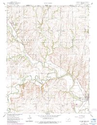
1966 Map of Hanover West
USGS Topo · Published 1983About this map
The Old Indian Treaty Boundary slices diagonally across this Kansas landscape, a visible remnant of 19th-century land divisions that predates the rectilinear township grid. The Little Blue River and Mill Creek define the local topography, their winding courses punctuated by numerous Sandpits that indicate the area's geological utility. The transportation network is anchored by the Union Pacific and Burlington Northern railroads, which served the agricultural settlements of Hanover and Hollenberg. Genealogists may find interest in the scattered markers of early community life, such as the Prall Cem and the Evangelical Ch near the Nebraska border. The map also documents mid-20th-century infrastructure, including the County Warren Airport and a network of pipelines crossing the townships of Franklin, Independence, and Charleston.
Find a feature on this map
27 named features on this map. Tap any name to fly to it.
Don’t see what you’re looking for? This feature index may not catch every label — zoom into the map to look around manually.
Map Details
Editions of this 1966 Hanover West Map
2 editions found
Other maps of this area

1889 · Marysville
USGS Topo · 1:125,000

1893 · Washington
USGS Topo · 1:125,000

1894 · Marysville
USGS Topo · 1:125,000

1955 · Manhattan
USGS Topo · 1:250,000

1955 · Lincoln
USGS Topo · 1:250,000

1956 · Manhattan
USGS Topo · 1:250,000

1957 · Manhattan
USGS Topo · 1:250,000

1957 · Lincoln
USGS Topo · 1:250,000

1958 · Lincoln
USGS Topo · 1:250,000

1966 · Washington
USGS Topo · 1:24,000