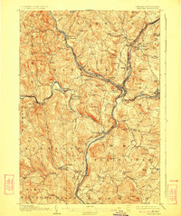
1908 Map of Hanover
USGS Topo · Published 1924About this map
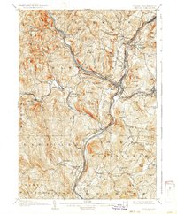
Dartmouth College anchors the northeastern corner of this terrain, overlooking the Connecticut River as it carves a border between Vermont and New Hampshire. The landscape is defined by the convergence of major waterways, including the White River and Ottauquechee River, which facilitated the development of critical transportation hubs like White River Junction. Here, the Central Vermont Railway and Boston and Maine R R intersect, reflecting the era's reliance on rail for commerce and travel between the hills and valleys.
Find a feature on this map
111 named features on this map. Tap any name to fly to it.
Don’t see what you’re looking for? This feature index may not catch every label — zoom into the map to look around manually.
Map Details
Editions of this 1908 Hanover Map
7 editions found
Other maps of this area

1896 · Strafford
USGS Topo · 1:62,500

1902 · Sunapee
USGS Topo · 1:62,500

1905 · Sunapee
USGS Topo · 1:62,500

1906 · Hanover
USGS Topo · 1:62,500

1907 · Sunapee
USGS Topo · 1:62,500

1908 · Hanover
USGS Topo · 1:62,500

1911 · Woodstock
USGS Topo · 1:62,500

1913 · Woodstock
USGS Topo · 1:62,500

1919 · Royalton
USGS Topo · 1:62,500

1924 · Randolph
USGS Topo · 1:48,000