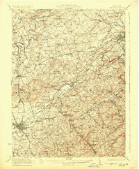
1922 Map of Hanover
USGS Topo · Published 1925About this map
Hanover and the surrounding townships of York County are defined by a dense network of early 20th-century rural infrastructure. The landscape is dotted with one-room schoolhouses like Julius School and Trimmers School, while community life centers on historic meeting places such as Lischy Church and Paradise Church. This era shows a transition in transportation, with the Lincoln Highway cutting through the center while the Pennsylvania Railroad and Western Maryland Railroad still serve as vital arteries for local industry. The importance of water power and small-scale manufacturing is evident at Menges Mills and Buhrmans Mill, alongside an Iron Ore Pit that hints at the region's mineral extraction. Notable junctions like Hanover Junction and small hubs like Thomasville reveal the connectivity of these agricultural and industrial settlements before the mid-century expansion of larger urban centers.
Find a feature on this map
159 named features on this map. Tap any name to fly to it.
Don’t see what you’re looking for? This feature index may not catch every label — zoom into the map to look around manually.
Map Details
Editions of this 1922 Hanover Map
5 editions found

Other maps of this area

1900 · Parkton
USGS Topo · 1:62,500

1902 · Parkton
USGS Topo · 1:62,500

1904 · Carlisle
USGS Topo · 1:62,500

1905 · Westminster
USGS Topo · 1:62,500

1906 · New Cumberland
USGS Topo · 1:62,500

1908 · Middletown
USGS Topo · 1:62,500

1908 · Gettysburg
USGS Topo · 1:62,500

1908 · York
USGS Topo · 1:62,500

1910 · York
USGS Topo · 1:62,500

1911 · Taneytown
USGS Topo · 1:62,500