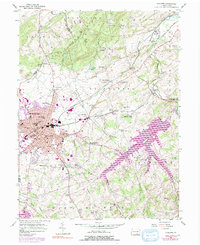
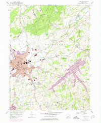
1954 Map of Hanover
USGS Topo · Published 1991About this map
The borough of Hanover serves as the industrial and residential core of this South Central Pennsylvania landscape, where the expansion of urban areas is tracked through 1973 revisions. The town's dense network of educational and civic institutions includes Eichelburg High Sch and the central Fairgrounds, while the surrounding countryside maintains a pattern of dispersed hamlets like Gnatstown and Moulstown. This transition from borough to farm is anchored by the dual presence of the Penn Central and Western Maryland railroads, which facilitated local trade for rural outposts such as Menges Mills and Porters Sideling.
Find a feature on this map
75 named features on this map. Tap any name to fly to it.
Don’t see what you’re looking for? This feature index may not catch every label — zoom into the map to look around manually.
Map Details
Editions of this 1954 Hanover Map
5 editions found
Other maps of this area

1905 · Westminster
USGS Topo · 1:62,500

1908 · Gettysburg
USGS Topo · 1:62,500

1911 · Taneytown
USGS Topo · 1:62,500

1920 · Hanover
USGS Topo · 1:62,500

1922 · Hanover
USGS Topo · 1:62,500

1942 · Gettysburg
USGS Topo · 1:125,000

1944 · Manchester
USGS Topo · 1:31,680

1944 · Mc Sherrystown
USGS Topo · 1:31,680

1944 · Littlestown
USGS Topo · 1:31,680

1944 · Lineboro
USGS Topo · 1:31,680