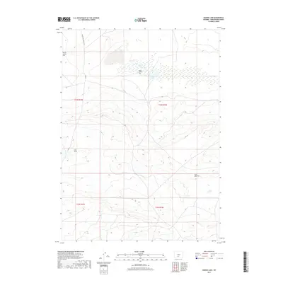
2017 Map of Hansen Lake
USGS Topo · Published 2017About this map
Hansen Lake and McGann Lake serve as focal points in this high-elevation basin within the Great Divide Basin. The landscape is defined by vast depressions like Chain Lakes Flat and Battle Spring Flat, where internal drainage creates a unique hydrographic environment far from any ocean outlet. Topographical relief is provided by Coal Butte and the distinct elevation change at Chain Lakes Rim, which marks the edge of the lower basin floor. Transportation through this isolated portion of Sweetwater County is facilitated by the Wamsutter Crooks Gap Rd, a route connecting remote resource areas. The presence of numerous wetlands surrounding the lakes indicates a delicate desert ecosystem where water dictates the movement of people and wildlife across the expansive t23n r94w and t23n r93w townships.
Find a feature on this map
12 named features on this map. Tap any name to fly to it.
Don’t see what you’re looking for? This feature index may not catch every label — zoom into the map to look around manually.
Map Details
Editions of this 2017 Hansen Lake Map
This is the sole edition of this map. No revisions or reprints were ever made.
Other maps of this area

1954 · Rawlins
USGS Topo · 1:250,000

1954 · Rock Springs
USGS Topo · 1:250,000

1955 · Lander
USGS Topo · 1:250,000

1955 · Casper
USGS Topo · 1:250,000

1958 · Rawlins
USGS Topo · 1:250,000

1958 · Casper
USGS Topo · 1:250,000

1958 · Lander
USGS Topo · 1:250,000

1958 · Rock Springs
USGS Topo · 1:250,000

1960 · Battle Spring
USGS Topo · 1:24,000

1960 · Hansen Lake NE
USGS Topo · 1:24,000