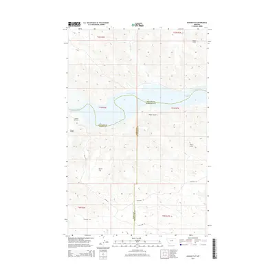
2014 Map of Hanson Flat
USGS Topo · Published 2014About this map
Missouri River water flows across this Central Montana landscape, marking the convergence of Phillips, Fergus, and Petroleum counties. The sheet captures the transition from riverine geography to the elevated plateau of Hanson Flat. Historical travel and movement across this uneven terrain are evidenced by a network of established paths, including the Skyline Trl, Musselshell Trl, and Horse Camp Trl.
Find a feature on this map
20 named features on this map. Tap any name to fly to it.
Don’t see what you’re looking for? This feature index may not catch every label — zoom into the map to look around manually.
Map Details
Editions of this 2014 Hanson Flat Map
This is the sole edition of this map. No revisions or reprints were ever made.
Other maps of this area

1954 · Lewistown
USGS Topo · 1:250,000

1959 · Lewistown
USGS Topo · 1:250,000

1965 · Dry Coulee
USGS Topo · 1:24,000

1965 · Lake Reservoir
USGS Topo · 1:24,000

1965 · Weingart Place NW
USGS Topo · 1:24,000

1971 · Blizzard Reservoir
USGS Topo · 1:24,000

1971 · Kepple Bottoms
USGS Topo · 1:24,000
1971 · Sagebrush Reservoir
USGS Topo · 1:24,000

1971 · Hanson Flat
USGS Topo · 1:24,000

1984 · Zortman
USGS Topo · 1:100,000