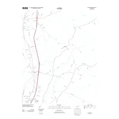
2013 Map of Hanson
USGS Topo · Published 2013About this map
Hanson serves as the primary hub of this 2013 survey, where local commerce centers around Mill St and N Livingston St. The geography is defined by a network of creeks, including Otter Cr, Narge Cr, and Elk Cr, which carve through the farmland north of Madisonville. The landscape is modern but deeply rooted in its local road names, reflecting established family homesteads along Zachary Spur, Ivan Edwards Ln, and Estill Baker Rd. In the north, Vandetta and Slaughters Lake provide distinct landmarks in a terrain dominated by the Edward T. Breathitt Pennyrile Pkwy. These corridors illustrate the shift from rural settlement to modern transit, while routes like Brick Church Rd and New Hope Church Rd point to the community's longstanding social centers.
Find a feature on this map
81 named features on this map. Tap any name to fly to it.
Don’t see what you’re looking for? This feature index may not catch every label — zoom into the map to look around manually.
Map Details
Editions of this 2013 Hanson Map
This is the sole edition of this map. No revisions or reprints were ever made.
Other maps of this area

1906 · Sebree
USGS Topo · 1:62,500

1907 · Earlington
USGS Topo · 1:48,000

1908 · Calhoun
USGS Topo · 1:62,500

1909 · Earlington
USGS Topo · 1:62,500

1909 · Madisonville
USGS Topo · 1:62,500

1949 · Sebree
USGS Topo · 1:24,000

1951 · Sebree
USGS Topo · 1:24,000

1952 · Sacramento
USGS Topo · 1:24,000

1952 · Calhoun
USGS Topo · 1:24,000

1952 · Beech Grove
USGS Topo · 1:24,000