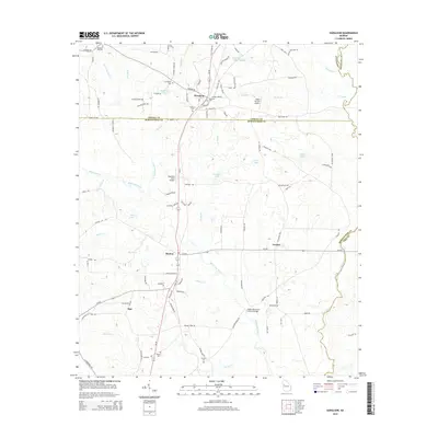
2014 Map of Haralson
USGS Topo · Published 2014About this map
The town of Haralson sits at the intersection of several county lines in this rural Georgia landscape, where agricultural tradition meets the slow expansion of private aviation. The area is defined by the drainage of White Oak Creek and its many tributaries, including Wolf Br and Beaver Cr, which carve through the terrain between the Coweta Co and Meriwether Co borders. A notable local landmark is the White Oak Creek Covered Bridge, situated southeast of the small settlement of Alvaton.
Find a feature on this map
107 named features on this map. Tap any name to fly to it.
Don’t see what you’re looking for? This feature index may not catch every label — zoom into the map to look around manually.
Map Details
Editions of this 2014 Haralson Map
This is the sole edition of this map. No revisions or reprints were ever made.
Other maps of this area

1953 · Atlanta
USGS Topo · 1:250,000

1957 · Atlanta
USGS Topo · 1:250,000

1958 · Atlanta
USGS Topo · 1:250,000

1965 · Senoia
USGS Topo · 1:24,000

1965 · Brooks
USGS Topo · 1:24,000

1965 · Sharpsburg
USGS Topo · 1:24,000
1971 · Luthersville
USGS Topo · 1:24,000
1971 · Greenville
USGS Topo · 1:24,000

1971 · Hollonville
USGS Topo · 1:24,000
1971 · Haralson
USGS Topo · 1:24,000