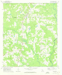
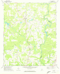
1971 Map of Haralson
USGS Topo · Published 1973About this map
The Seaboard Coast Line railroad creates a north-south spine through this section of Georgia, anchoring the small settlements of Haralson and Alvaton as it crosses the county line. The landscape is defined by the drainage of White Oak Creek and its many tributaries, such as Winky Branch and Wolf Branch, as they flow toward the Flint River at the southeastern corner of the quadrangle.
Find a feature on this map
43 named features on this map. Tap any name to fly to it.
Don’t see what you’re looking for? This feature index may not catch every label — zoom into the map to look around manually.
Map Details
Editions of this 1971 Haralson Map
2 editions found
Other maps of this area

1953 · Atlanta
USGS Topo · 1:250,000

1957 · Atlanta
USGS Topo · 1:250,000

1958 · Atlanta
USGS Topo · 1:250,000

1965 · Senoia
USGS Topo · 1:24,000

1965 · Brooks
USGS Topo · 1:24,000

1965 · Sharpsburg
USGS Topo · 1:24,000
1971 · Luthersville
USGS Topo · 1:24,000
1971 · Greenville
USGS Topo · 1:24,000

1971 · Hollonville
USGS Topo · 1:24,000
1971 · Gay
USGS Topo · 1:24,000