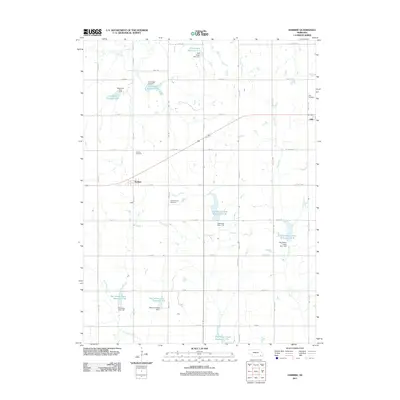
2011 Map of Harbine
USGS Topo · Published 2011About this map
Harbine and Ellis anchor this section of Jefferson County, where the landscape is defined by the systematic management of the Big Indian Creek and Cub Creek watersheds. The area is notable for its numerous water control structures, including the Big Indian Creek Reservoir 17-B and the Cub Creek Reservoir G-7, reflecting a highly engineered rural environment focused on conservation. Genealogists will find significant value in the local burial grounds, such as Hope Church Cemetery, Harbine Cemetery, and Ellis Cemetery, which provide vital links to the families who settled this agricultural region. The grid of section roads, from 719th Rd down to PWF Rd, demonstrates the enduring influence of the Public Land Survey System on the Nebraska prairie, maintaining a remarkably consistent spatial organization into the 21st century.
Find a feature on this map
44 named features on this map. Tap any name to fly to it.
Don’t see what you’re looking for? This feature index may not catch every label — zoom into the map to look around manually.
Map Details
Editions of this 2011 Harbine Map
This is the sole edition of this map. No revisions or reprints were ever made.
Other maps of this area

1955 · Lincoln
USGS Topo · 1:250,000

1957 · Lincoln
USGS Topo · 1:250,000

1957 · Plymouth
USGS Topo · 1:24,000

1957 · Beatrice West
USGS Topo · 1:24,000

1958 · Lincoln
USGS Topo · 1:250,000

1961 · Western SE
USGS Topo · 1:24,000

1970 · Diller NE
USGS Topo · 1:24,000
1970 · Harbine
USGS Topo · 1:24,000
1970 · Endicott
USGS Topo · 1:24,000

1970 · Diller
USGS Topo · 1:24,000