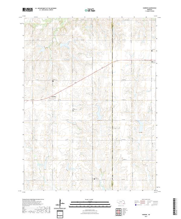
2021 Map of Harbine
USGS Topo · Published 2021About this map
Harbine and Ellis anchor this rural landscape along the boundary of Jefferson and Gage Counties. The region is defined by the headwaters and tributaries of several prominent drainage systems, including Cub Creek in the north and the south-flowing Big Indian Creek. Modern water management is visible through numerous impoundments such as Cub Creek Reservoir G-7 and Big Indian Creek Reservoir 8-B, which sit amidst a strictly organized grid of agricultural roads. For the local historian, the map preserves the exact locations of several community burial grounds, including the Harbine Cemetery and the isolated Prairie Home Cemetery. The layout of the roads, such as West Belvedere Road and PWF Road, illustrates the enduring structure of Nebraska's section-line planning in the early twenty-first century.
Find a feature on this map
36 named features on this map. Tap any name to fly to it.
Don’t see what you’re looking for? This feature index may not catch every label — zoom into the map to look around manually.
Map Details
Editions of this 2021 Harbine Map
This is the sole edition of this map. No revisions or reprints were ever made.
Other maps of this area

1955 · Lincoln
USGS Topo · 1:250,000

1957 · Lincoln
USGS Topo · 1:250,000

1957 · Plymouth
USGS Topo · 1:24,000

1957 · Beatrice West
USGS Topo · 1:24,000

1958 · Lincoln
USGS Topo · 1:250,000

1961 · Western SE
USGS Topo · 1:24,000

1970 · Diller NE
USGS Topo · 1:24,000
1970 · Harbine
USGS Topo · 1:24,000
1970 · Endicott
USGS Topo · 1:24,000

1970 · Diller
USGS Topo · 1:24,000