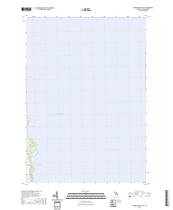
2023 Map of Harbor Beach OE E
USGS Topo · Published 2023About this map
Lake Huron dominates this coastal landscape in eastern Huron County, where the shoreline is defined by the gentle indentations of Sharpe Bay and Purdy Bay. This map captures the modern residential and recreational layout of the Thumb region, illustrating a network of coastal roads such as Lakeside Dr and S Lakeshore Rd that parallel the water. The survey maintains the historic Public Land Survey System framework, noting the division between t16n r16e and t15n r16e. Inland, the area transitions to a rural grid represented by Helena Rd, showing the continued significance of these primary thoroughfares in connecting the small lakeside communities. The map provides a clear view of the contemporary interface between the vast Great Lakes water system and the settled Michigan shoreline.
Find a feature on this map
9 named features on this map. Tap any name to fly to it.
Don’t see what you’re looking for? This feature index may not catch every label — zoom into the map to look around manually.
Map Details
Editions of this 2023 Harbor Beach OE E Map
This is the sole edition of this map. No revisions or reprints were ever made.
Other maps of this area

1954 · Flint
USGS Topo · 1:250,000

1958 · Flint
USGS Topo · 1:250,000

1963 · Forestville
USGS Topo · 1:24,000

1963 · Ruth
USGS Topo · 1:24,000

1970 · Port Hope
USGS Topo · 1:24,000

1970 · Harbor Beach
USGS Topo · 1:24,000

1984 · Harbor Beach
USGS Topo · 1:100,000
2011 · Forestville
USGS Topo · 1:24,000
2011 · Harbor Beach
USGS Topo · 1:24,000
2011 · Harbor Beach OE E
USGS Topo · 1:24,000