
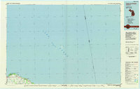
1970 Map of Port Hope
USGS Topo · Published 1973About this map
The shoreline of Lake Huron defines this section of the Thumb, where the village of Port Hope serves as a central hub for the surrounding agricultural townships of Gore and Rubicon. In the early 1970s, the local economy and travel patterns are clearly visible through the Chesapeake and Ohio railroad line running parallel to the coast and the presence of a small Landing Strip south of the village. The landscape is dotted with generational markers, including the Gore Cem near Whiskey Harbor and Forest Bay Cem further south.
Find a feature on this map
37 named features on this map. Tap any name to fly to it.
Don’t see what you’re looking for? This feature index may not catch every label — zoom into the map to look around manually.
Map Details
Editions of this 1970 Port Hope Map
This is the sole edition of this map. No revisions or reprints were ever made.
Other maps of this area

1954 · Flint
USGS Topo · 1:250,000

1954 · Tawas City
USGS Topo · 1:250,000

1958 · Flint
USGS Topo · 1:250,000

1958 · Tawas City
USGS Topo · 1:250,000

1970 · Redman
USGS Topo · 1:24,000

1970 · Huron City
USGS Topo · 1:24,000

1970 · Harbor Beach
USGS Topo · 1:24,000

1970 · Bad Axe SE
USGS Topo · 1:24,000

1984 · Harbor Beach
USGS Topo · 1:100,000
1984 · Pointe Aux Barques
USGS Topo · 1:100,000