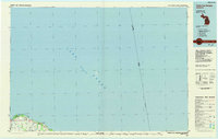
1984 Map of Pointe Aux Barques
USGS Topo · Published 1985About this map
Lake Huron dominates this 1980s planimetric survey, which focuses on the northernmost tip of Michigan's thumb. The map details the transition from the maritime expanse to the rugged coastlines of Pointe Aux Barques and Burnt Cabin Point. Inland, the settlement pattern is sparse, defined by small communities like Port Austin and Huron City that are connected by a network of drainage ways including Bird Creek and Willow Creek.
Find a feature on this map
18 named features on this map. Tap any name to fly to it.
Don’t see what you’re looking for? This feature index may not catch every label — zoom into the map to look around manually.
Map Details
Editions of this 1984 Pointe Aux Barques Map
2 editions found
Other maps of this area

1954 · Flint
USGS Topo · 1:250,000

1954 · Tawas City
USGS Topo · 1:250,000

1958 · Flint
USGS Topo · 1:250,000

1958 · Tawas City
USGS Topo · 1:250,000

1970 · Port Hope
USGS Topo · 1:24,000

1970 · Port Austin East
USGS Topo · 1:24,000

1970 · Kinde East
USGS Topo · 1:24,000

1970 · Redman
USGS Topo · 1:24,000

1970 · Huron City
USGS Topo · 1:24,000

1970 · Port Austin West
USGS Topo · 1:24,000