
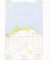
1970 Map of Port Austin East
USGS Topo · Published 1973About this map
Port Austin and Grind Stone City anchor the northern tip of Michigan's Thumb, where the land meets the cold waters of Lake Huron. The landscape is a distinct blend of maritime industry and agricultural drainage, evidenced by the numerous named channels like Hellums Drain and Dwight Drain that crisscross the interior farms. Along the coast, the heritage of the region's grindstone industry is visible through several marked quarries near the shore.
Find a feature on this map
40 named features on this map. Tap any name to fly to it.
Don’t see what you’re looking for? This feature index may not catch every label — zoom into the map to look around manually.
Map Details
Editions of this 1970 Port Austin East Map
2 editions found
Other maps of this area

1954 · Flint
USGS Topo · 1:250,000

1954 · Tawas City
USGS Topo · 1:250,000

1958 · Flint
USGS Topo · 1:250,000

1958 · Tawas City
USGS Topo · 1:250,000

1970 · Kinde East
USGS Topo · 1:24,000

1970 · Redman
USGS Topo · 1:24,000

1970 · Huron City
USGS Topo · 1:24,000

1970 · Port Austin West
USGS Topo · 1:24,000

1970 · Kinde West
USGS Topo · 1:24,000

1984 · Harbor Beach
USGS Topo · 1:100,000
Featured Places
- Port Austin, MI
- Port Austin Township, MI
- Point Aux Barques, MI
- Pointe aux Barques, MI
- Huron Township, MI