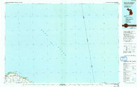
1984 Map of Pointe Aux Barques
USGS Topo · Published 1991About this map
Lake Huron dominates this 1980s-era survey, where the northern tip of Michigan's Thumb meets the international boundary with Ontario. The shoreline is defined by the sharp transition from the residential and agricultural lands of Dwight and Port Austin townships to the rocky protrusions of Burnt Cabin Point and Pointe aux Barques. The industrial heritage of the coast is evident at Grind Stone City, where local quarries once fueled a thriving tool industry. Traces of historical transport remain visible through the Old RR grade that terminates near the coast, while the natural geography is marked by small inlets like Alaska Bay and Eagle Bay. This study captures the landscape just as many of these maritime settlements were transitioning from their industrial roots toward their modern character as summer destinations.
Find a feature on this map
20 named features on this map. Tap any name to fly to it.
Don’t see what you’re looking for? This feature index may not catch every label — zoom into the map to look around manually.
Map Details
Editions of this 1984 Pointe Aux Barques Map
2 editions found
Other maps of this area

1954 · Flint
USGS Topo · 1:250,000

1954 · Tawas City
USGS Topo · 1:250,000

1958 · Flint
USGS Topo · 1:250,000

1958 · Tawas City
USGS Topo · 1:250,000

1970 · Port Hope
USGS Topo · 1:24,000

1970 · Port Austin East
USGS Topo · 1:24,000

1970 · Kinde East
USGS Topo · 1:24,000

1970 · Redman
USGS Topo · 1:24,000

1970 · Huron City
USGS Topo · 1:24,000

1970 · Port Austin West
USGS Topo · 1:24,000