
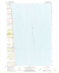
1963 Map of Forestville
USGS Topo · Published 1964About this map
Forestville and White Rock line the western shore of Lake Huron on this coastal survey from the early 1960s. The landscape is defined by the sharp transition from the open water to the agricultural uplands of the Thumb, where the Huron Co - Sanilac Co line divides the terrain. Small creeks like Mill Creek and White River cut through the glacial till to reach the lake, creating the natural drainage that dictated early settlement patterns.
Find a feature on this map
32 named features on this map. Tap any name to fly to it.
Don’t see what you’re looking for? This feature index may not catch every label — zoom into the map to look around manually.
Map Details
Editions of this 1963 Forestville Map
2 editions found
Other maps of this area

1954 · Flint
USGS Topo · 1:250,000

1958 · Flint
USGS Topo · 1:250,000

1963 · Ruth
USGS Topo · 1:24,000

1963 · Deckerville
USGS Topo · 1:24,000

1963 · Richmondville
USGS Topo · 1:24,000

1970 · Harbor Beach
USGS Topo · 1:24,000

1984 · Harbor Beach
USGS Topo · 1:100,000
2011 · Deckerville
USGS Topo · 1:24,000
2011 · Forestville
USGS Topo · 1:24,000
2011 · Harbor Beach
USGS Topo · 1:24,000