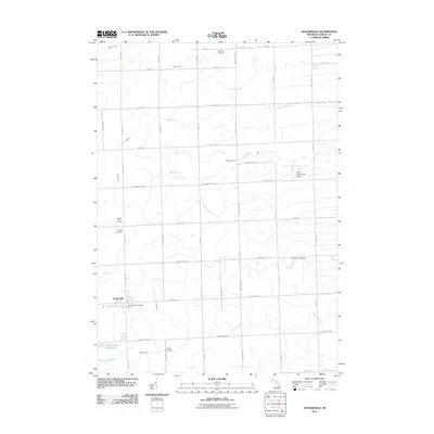
2011 Map of Deckerville
USGS Topo · Published 2011About this map
The village of Deckerville serves as the central hub of this agricultural landscape in Michigan's Thumb region, defined by a rigid grid of country roads and numerous small family and community burial grounds. Genealogists can find several key sites including the Rusnell Farm Cemetery, Rosbury Cemetery, and East Marion Cemetery, which are scattered throughout the surrounding townships. The local economy and infrastructure are highlighted by the Deckerville Post Office and the Indian Creek Ranch Airport to the east.
Find a feature on this map
41 named features on this map. Tap any name to fly to it.
Don’t see what you’re looking for? This feature index may not catch every label — zoom into the map to look around manually.
Map Details
Editions of this 2011 Deckerville Map
This is the sole edition of this map. No revisions or reprints were ever made.
Other maps of this area

1954 · Flint
USGS Topo · 1:250,000

1958 · Flint
USGS Topo · 1:250,000

1963 · Forestville
USGS Topo · 1:24,000

1963 · Ruth
USGS Topo · 1:24,000

1963 · Sandusky
USGS Topo · 1:24,000

1963 · Port Sanilac
USGS Topo · 1:24,000

1963 · Minden City
USGS Topo · 1:24,000

1963 · Palms
USGS Topo · 1:24,000

1963 · Deckerville
USGS Topo · 1:24,000

1963 · Richmondville
USGS Topo · 1:24,000
Featured Places
- Deckerville, MI
- Forester Township, MI
- Delaware Township, MI
- Bridgehampton Township, MI
- Marion Township, MI