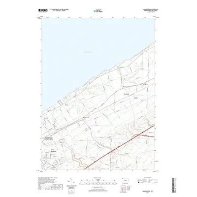
2019 Map of Harborcreek
USGS Topo · Published 2019About this map
The southern shoreline of Lake Erie defines the character of this Erie County landscape, where numerous parallel creeks have carved deep drainage patterns toward the water. Communities like Harborcreek, Moorheadville, and Fairfield are connected by a network of historical transit corridors, including Buffalo Rd and E Lake Rd, which run parallel to the coast. The map reveals a high concentration of small family and community burial grounds, such as Gospel Hill Burial Ground, Jacob Cem, and Hoag Cem, offering significant value for genealogical research into the area's early settlers.
Find a feature on this map
96 named features on this map. Tap any name to fly to it.
Don’t see what you’re looking for? This feature index may not catch every label — zoom into the map to look around manually.
Map Details
Editions of this 2019 Harborcreek Map
This is the sole edition of this map. No revisions or reprints were ever made.
Other maps of this area

1899 · Erie
USGS Topo · 1:62,500

1900 · Erie
USGS Topo · 1:62,500

1913 · North East
USGS Topo · 1:62,500

1915 · North East
USGS Topo · 1:62,500

1943 · North East
USGS Topo · 1:62,500

1950 · Erie
USGS Topo · 1:250,000

1957 · Erie South
USGS Topo · 1:24,000
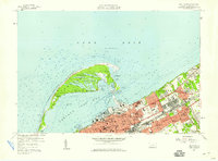
1957 · Erie North
USGS Topo · 1:24,000

1959 · Erie
USGS Topo · 1:250,000

1960 · Buffalo
USGS Topo · 1:250,000
Featured Places
- Harborcreek Township, PA
- North East Township, PA
- Sheridan Corners, PA
- Greenfield Township, PA
- Moorhead, Harborcreek Township