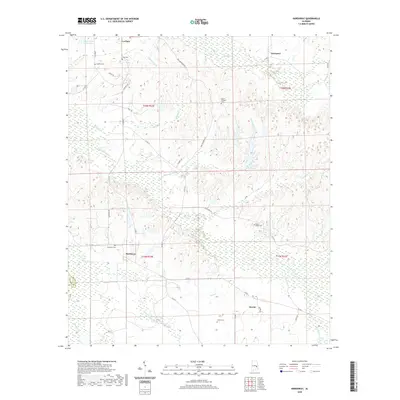
2020 Map of Hardaway
USGS Topo · Published 2020About this map
The lowlands of western Macon County are defined by an intricate network of waterways, including the winding Cubahatchee Cr and Calebee Cr, which feed the surrounding wetlands and bottomlands. This 2020 edition provides a modern topographic record of the Hardaway area, showing the enduring footprint of rural communities such as La Place, Downs, and Liverpool. The landscape is dotted with several family and community burial grounds, including Ambers Cem, Cole Cem, and Mount Pleasant Cem, which serve as vital landmarks for local genealogical research.
Find a feature on this map
42 named features on this map. Tap any name to fly to it.
Don’t see what you’re looking for? This feature index may not catch every label — zoom into the map to look around manually.
Map Details
Editions of this 2020 Hardaway Map
This is the sole edition of this map. No revisions or reprints were ever made.
Other maps of this area

1955 · Phenix City
USGS Topo · 1:250,000

1957 · Phenix City
USGS Topo · 1:250,000

1958 · Phenix City
USGS Topo · 1:250,000

1971 · Tuskegee
USGS Topo · 1:24,000

1971 · Shorter
USGS Topo · 1:24,000

1971 · La Place
USGS Topo · 1:24,000

1971 · Hardaway
USGS Topo · 1:24,000

1971 · Thompson
USGS Topo · 1:24,000
1971 · Fitzpatrick
USGS Topo · 1:24,000
1971 · Chesson
USGS Topo · 1:24,000