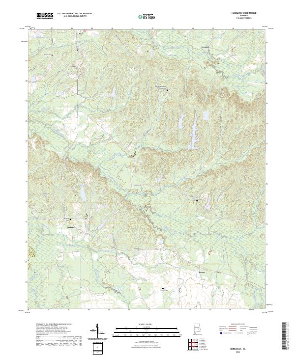
2024 Map of Hardaway
USGS Topo · Published 2024About this map
Calebee Creek and Gubahatchee Creek dominate this central Alabama landscape, creating a network of winding tributaries that define the local geography. Small settlements and historical congregations are scattered throughout the region, including La Place and Liverpool in the north and Hardaway and Downs in the south. The abundance of named family cemeteries, such as Cole Cem, Ambers Cem, and Grimm Cem, provides a significant record of the area's ancestral residents. The land is largely rural, characterized by the convergence of several waterways like Thobolocco Branch and Beaverdam Creek. Local faith and community life are anchored by landmarks such as the New Mount Pleasant Baptist Church and Mount Pisgah Cem, reflecting the enduring settlement patterns of Macon County near the Bullock County line.
Find a feature on this map
46 named features on this map. Tap any name to fly to it.
Don’t see what you’re looking for? This feature index may not catch every label — zoom into the map to look around manually.
Map Details
Editions of this 2024 Hardaway Map
This is the sole edition of this map. No revisions or reprints were ever made.
Other maps of this area

1955 · Phenix City
USGS Topo · 1:250,000

1957 · Phenix City
USGS Topo · 1:250,000

1958 · Phenix City
USGS Topo · 1:250,000

1971 · Tuskegee
USGS Topo · 1:24,000

1971 · Shorter
USGS Topo · 1:24,000

1971 · La Place
USGS Topo · 1:24,000

1971 · Hardaway
USGS Topo · 1:24,000

1971 · Thompson
USGS Topo · 1:24,000
1971 · Fitzpatrick
USGS Topo · 1:24,000
1971 · Chesson
USGS Topo · 1:24,000