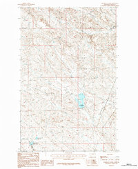
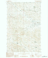
1984 Map of Hardpan Coulee
USGS Topo · Published 1984About this map
The eponymous Hardpan Coulee defines the drainage patterns of this Valley County landscape, where various forks and coulees converge in a complex hydrographic network. Small-scale water management projects are central to the terrain here, notably the VR-2 Reservoir and the adjacent Beechnut Reservoir and North Beaver Reservoir to the south. These catchments, combined with the winding paths of Antelope Creek and Brazil Creek, illustrate the historical efforts to capture and utilize runoff in the eastern Montana plains. The map also records the distinct paths of the North Fork Pot Hole Coulee and its southern counterpart, providing a detailed look at the local geography of the North Fork Little Beaver Creek drainage before the turn of the twenty-first century.
Find a feature on this map
11 named features on this map. Tap any name to fly to it.
Don’t see what you’re looking for? This feature index may not catch every label — zoom into the map to look around manually.
Map Details
Editions of this 1984 Hardpan Coulee Map
This is the sole edition of this map. No revisions or reprints were ever made.
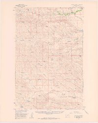
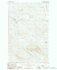
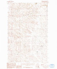
Other maps of this area

1943 · Glasgow
USGS Topo · 1:125,000

1954 · Glasgow
USGS Topo · 1:250,000

1957 · Glasgow
USGS Topo · 1:250,000

1958 · Glasgow
USGS Topo · 1:250,000
1958 · Miller Coulee
USGS Topo · 1:62,500
1958 · Billick Coulee
USGS Topo · 1:24,000
1969 · Vandalia
USGS Topo · 1:24,000
1984 · Burnett Flats West
USGS Topo · 1:24,000
1984 · Burnett Flats East
USGS Topo · 1:24,000
1984 · Ashford Coulee
USGS Topo · 1:24,000