
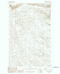
1984 Map of Ashford Coulee
USGS Topo · Published 1984About this map
Ashford Spring serves as a vital water source in this corner of Valley County, Montana, where the landscape is defined by the complex drainage systems of the Missouri River watershed. The terrain is deeply incised by multiple watercourses, including the prominent Ashford Coulee and McNab Coulee in the northwest, and Ash Coulee in the northeast. This 1984 provisional survey illustrates the ranching infrastructure typical of the high plains, featuring man-made catchments like Bear Tracks Reservoir and Luther Reservoir to support livestock in the arid environment. The southern portion of the quadrangle is marked by the course of Square Creek, while North Fork Antelope Creek drains the eastern slopes, showing a network of unimproved roads and trails that connect these isolated water points across the prairie.
Find a feature on this map
10 named features on this map. Tap any name to fly to it.
Don’t see what you’re looking for? This feature index may not catch every label — zoom into the map to look around manually.
Map Details
Editions of this 1984 Ashford Coulee Map
This is the sole edition of this map. No revisions or reprints were ever made.
Other maps of this area

1905 · Saco Special
USGS Topo · 1:62,500

1906 · Hinsdale Special Map
USGS Topo · 1:62,500

1954 · Glasgow
USGS Topo · 1:250,000

1957 · Glasgow
USGS Topo · 1:250,000

1958 · Glasgow
USGS Topo · 1:250,000
1984 · Hardpan Coulee
USGS Topo · 1:24,000
1984 · Saco
USGS Topo · 1:24,000
1984 · Flat Coulee
USGS Topo · 1:24,000
1984 · Christmas Reservoir
USGS Topo · 1:24,000
1984 · Hinsdale SE
USGS Topo · 1:24,000