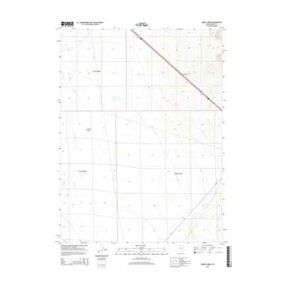
2014 Map of Hardy Creek
USGS Topo · Published 2014About this map
Goshute Valley dominates this high-desert landscape in Elko County, where the topography shifts from flat basin floor to the rising slopes of the Pequop Mountains. The drainage patterns of Hardy Cr and Nanny Cr are clearly visible as they descend toward the valley floor, illustrating the hydrography of this arid region. This 2014 survey captures a moment when transportation in the area relied heavily on Alt 93, which cuts diagonally across the northeastern corner of the map, and the unpaved route of Cr-789 winding through the southern sections. The map provides a precise view of public land surveying divisions, including the boundaries of t36n r66e and t35n r67e, which are essential for property researchers and genealogists tracing land titles in this part of rural Nevada.
Find a feature on this map
9 named features on this map. Tap any name to fly to it.
Don’t see what you’re looking for? This feature index may not catch every label — zoom into the map to look around manually.
Map Details
Editions of this 2014 Hardy Creek Map
This is the sole edition of this map. No revisions or reprints were ever made.
Other maps of this area

1955 · Wells
USGS Topo · 1:250,000

1955 · Elko
USGS Topo · 1:250,000

1958 · Wells
USGS Topo · 1:250,000

1958 · Elko
USGS Topo · 1:250,000

1961 · Wells
USGS Topo · 1:250,000

1962 · Elko
USGS Topo · 1:250,000

1965 · Elko
USGS Topo · 1:250,000

1967 · Cobre SE
USGS Topo · 1:24,000

1967 · Cobre
USGS Topo · 1:24,000

1968 · Independence Valley NE
USGS Topo · 1:24,000