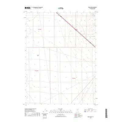
2018 Map of Hardy Creek
USGS Topo · Published 2018About this map
Goshute Valley defines this high-desert basin in eastern Elko County, where the landscape is shaped by long north-south drainages and the expansive flatlands of the Great Basin. The hydrology of the area is primarily defined by the seasonal flow of Hardy Cr and its tributary Nanny Cr, which descend from the eastern highlands toward the valley floor. The map highlights the vast scale of the Public Land Survey System grids, showing the intersection of several townships including t36n r66e and t35n r67e. In the northern portion of the quadrangle, transportation infrastructure is marked by the presence of Alt 93 and Interstate 80, indicating this area's role as a transit corridor through the Nevada wilderness. This 2018 survey provides a precise look at the contemporary topography and drainage patterns before they are further impacted by regional water use or climate shifts.
Find a feature on this map
9 named features on this map. Tap any name to fly to it.
Don’t see what you’re looking for? This feature index may not catch every label — zoom into the map to look around manually.
Map Details
Editions of this 2018 Hardy Creek Map
This is the sole edition of this map. No revisions or reprints were ever made.
Other maps of this area

1955 · Wells
USGS Topo · 1:250,000

1955 · Elko
USGS Topo · 1:250,000

1958 · Wells
USGS Topo · 1:250,000

1958 · Elko
USGS Topo · 1:250,000

1961 · Wells
USGS Topo · 1:250,000

1962 · Elko
USGS Topo · 1:250,000

1965 · Elko
USGS Topo · 1:250,000

1967 · Cobre SE
USGS Topo · 1:24,000

1967 · Cobre
USGS Topo · 1:24,000

1968 · Independence Valley NE
USGS Topo · 1:24,000