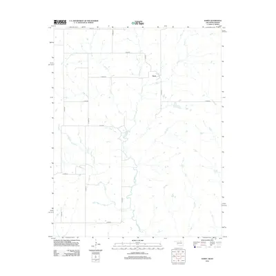
2012 Map of Hardy
USGS Topo · Published 2012About this map
Hardy sits at the heart of this rural landscape where the northern Oklahoma border meets southern Kansas. The area is defined by a sparse network of county roads and numerous small watercourses that flow through the local drainages. Little Beaver Cr and Mud Cr wind through the western and central sections, while Myers Cr and Rabbit Cr drain the eastern reaches. The survey shows a distinct grid of agricultural land parcels served by named thoroughfares like N Hardy Ln and E Indian Rd. This document captures the quiet, persistent rural character of Kay County in the early 21st century, illustrating how the historical settlement of Hardy remains tied to its creek-riven topography and local road system.
Find a feature on this map
19 named features on this map. Tap any name to fly to it.
Don’t see what you’re looking for? This feature index may not catch every label — zoom into the map to look around manually.
Map Details
Editions of this 2012 Hardy Map
This is the sole edition of this map. No revisions or reprints were ever made.
Other maps of this area

1889 · Burden
USGS Topo · 1:125,000

1916 · Foraker
USGS Topo · 1:62,500

1935 · Kaw
USGS Topo · 1:62,500

1955 · Wichita
USGS Topo · 1:250,000

1955 · Enid
USGS Topo · 1:250,000

1958 · Enid
USGS Topo · 1:250,000

1958 · Wichita
USGS Topo · 1:250,000

1962 · Dexter SW
USGS Topo · 1:24,000

1963 · Uncas
USGS Topo · 1:24,000

1963 · Kaw City NW
USGS Topo · 1:24,000