2022 Map of Hargill
USGS Topo · Published 2022About this map
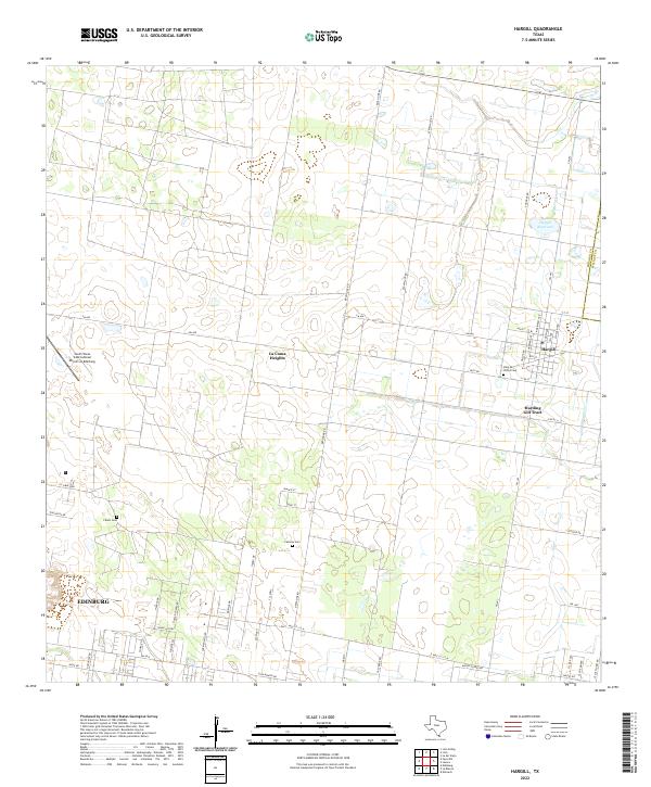
Hargill and Edinburg anchor this segment of the Rio Grande Valley, where the grid of the agricultural landscape meets the northern edge of the metropolitan area. The sheet shows a network of farm-to-market roads and local routes like FM 490 and Brushline Rd, which connect rural residential areas such as La Coma Heights with the vast irrigated fields of the Harding Gill Tract. The infrastructure of the region is well-defined, from the Hargill Reservoir to the South Texas International Airport at Edinburg, illustrating the region's mix of modern aviation and traditional farming. For those researching local families, the presence of several burial grounds, including La Paz Cem, Cavazos Cem, and Cibolo Cem, provides critical geographic context for the area's established ranching and farming communities near the Hidalgo County line.
Find a feature on this map
56 named features on this map. Tap any name to fly to it.
Don’t see what you’re looking for? This feature index may not catch every label — zoom into the map to look around manually.
Map Details
Editions of this 2022 Hargill Map
This is the sole edition of this map. No revisions or reprints were ever made.
Historical Maps of Hillcrest Terrace Colonia Through Time
Featured Locations
- Doolittle Acres Colonia, TX
- Edinburg, TX
- Edinburg Acres Colonia, TX
- Hillcrest Terrace Colonia, TX
- Harding Gill Tract Colonia, TX