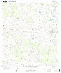
1963 Map of Hargill
USGS Topo · Published 1965About this map
The San Salvador Field gas production area dominates this mid-century landscape in the Rio Grande Valley, where energy extraction and irrigation infrastructure define the terrain. The small community of Hargill serves as a focal point, situated at the junction of the Missouri Pacific railroad and a network of elevated water channels. Notable irrigation features like Hargill Reservoir and an extensive Aqueduct system illustrate the region's managed agricultural environment.
Find a feature on this map
21 named features on this map. Tap any name to fly to it.
Don’t see what you’re looking for? This feature index may not catch every label — zoom into the map to look around manually.
Map Details
Editions of this 1963 Hargill Map
2 editions found
Other maps of this area

1922 · La Sal Vieja
USGS Topo · 1:62,500

1939 · Linn
USGS Topo · 1:62,500

1949 · Mc Allen
USGS Topo · 1:250,000

1953 · Brownsville
USGS Topo · 1:250,000

1954 · McAllen
USGS Topo · 1:250,000

1956 · La Sal Vieja
USGS Topo · 1:24,000

1956 · La Sal Vieja
USGS Topo · 1:62,500

1956 · Brownsville
USGS Topo · 1:250,000

1956 · Port Isabel
USGS Topo · 1:250,000
1957 · Lasara
USGS Topo · 1:24,000
Featured Places
- Edinburg, TX
- Edinburg Acres Colonia, TX
- Ingle-Doolittle Colonia, TX
- Harding Gill Tract Colonia, TX
- La Coma Heights Colonia, TX