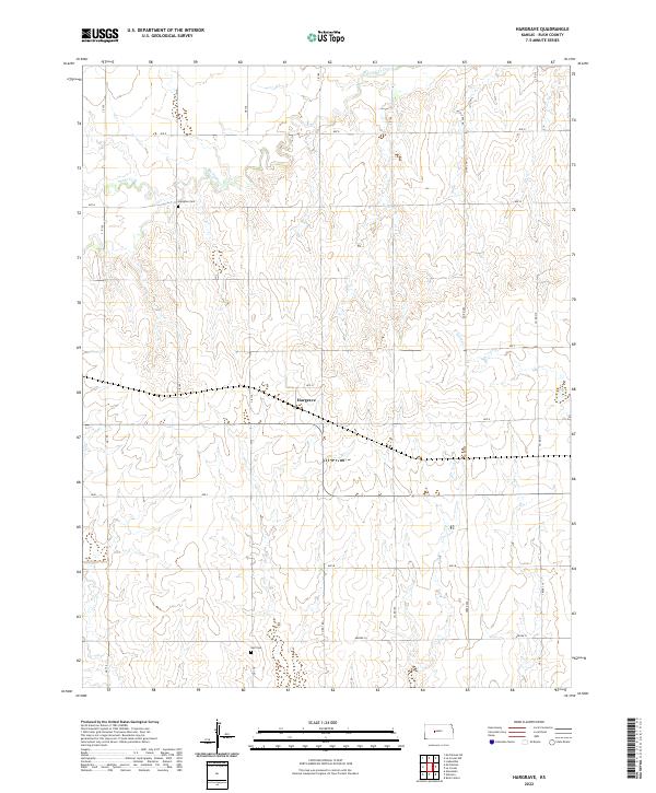
2022 Map of Hargrave
USGS Topo · Published 2022About this map
Hargrave sits at the center of this high-plains landscape, where the agricultural grid of Rush County is shaped by a series of north-flowing intermittent drainage systems. The settlement is positioned along a primary east-west corridor, surrounded by a terrain defined by the deep incisions of Big Timber Cr and Snake Cr. For local historians and genealogists, the map preserves the locations of two distinct burial sites: Hampton Cem to the northwest of the main settlement and Hall Cem situated further south near the section line of Township 18 South. These landmarks, alongside the detailed labeling of county roads like CR 170 and CR 180, illustrate the established rural infrastructure of the early 21st century. The landscape's character is further defined by the winding paths of Sand Cr and Creek 210, which carve through the contour lines of the prairie uplands.
Find a feature on this map
31 named features on this map. Tap any name to fly to it.
Don’t see what you’re looking for? This feature index may not catch every label — zoom into the map to look around manually.
Map Details
Editions of this 2022 Hargrave Map
This is the sole edition of this map. No revisions or reprints were ever made.
Other maps of this area

1889 · Larned
USGS Topo · 1:125,000

1891 · Larned
USGS Topo · 1:125,000

1892 · Ness
USGS Topo · 1:125,000

1893 · Ellis
USGS Topo · 1:125,000

1894 · Ness
USGS Topo · 1:125,000

1896 · Hays
USGS Topo · 1:125,000

1955 · Great Bend
USGS Topo · 1:250,000

1957 · Great Bend
USGS Topo · 1:250,000

1958 · Great Bend
USGS Topo · 1:250,000

1965 · Mc Cracken
USGS Topo · 1:24,000