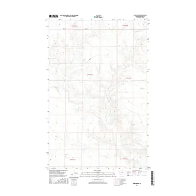
2017 Map of Harlem NW
USGS Topo · Published 2017About this map
The northern reaches of Thirtymile Cr characterize this portion of Blaine County, where the landscape is defined by the dendritic branching of high-plains waterways. The map illustrates the convergence of E Br Thirtymile Cr and other small drainages such as W Forgey Cr and Nessler Cr, which carve subtle relief into the terrain. Human development is sparse in this 2017 record, centered primarily on the corridor of Oberg Rd as it traverses the northern sections. The surveyor's grid, including t34n r21e and t35n r21e, provides the primary structural framework for this open country, reflecting the long-standing rectangular survey system used to organize the American West. The lack of concentrated settlements or industrial sites underscores the region's enduring character as an open grazing or agricultural landscape, where water remains the most significant geographical marker.
Find a feature on this map
11 named features on this map. Tap any name to fly to it.
Don’t see what you’re looking for? This feature index may not catch every label — zoom into the map to look around manually.
Map Details
Editions of this 2017 Harlem NW Map
This is the sole edition of this map. No revisions or reprints were ever made.
Other maps of this area

1904 · Chinook
USGS Topo · 1:62,500

1905 · Harlem
USGS Topo · 1:62,500

1912 · Zurich
USGS Topo · 1:125,000

1913 · Cherry Ridge
USGS Topo · 1:125,000

1953 · Havre
USGS Topo · 1:250,000

1957 · Havre
USGS Topo · 1:250,000

1958 · Havre
USGS Topo · 1:250,000
1964 · Fort Belknap Siding
USGS Topo · 1:24,000
1964 · Harlem
USGS Topo · 1:24,000
1964 · Zurich
USGS Topo · 1:24,000