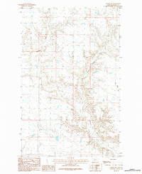
1984 Map of Harlem NW
USGS Topo · Published 1984About this map
Thirtymile Creek carves a complex drainage system through the Northern Montana plains in this 1984 provisional survey. The landscape is defined by the erosion patterns of the East Branch Thirtymile Creek and West Forgey Creek, revealing the intricate topography of the Missouri River watershed in northern Blaine County. This mapping, compiled from 1975 aerial photography and field-checked in 1979, records the rural land divisions and natural watercourses before modern shifts in regional land management. The grid-like precision of the sections contrasts with the winding, seasonal creek beds, providing a detailed record of the physical geography of the High Plains near the Canadian border.
Find a feature on this map
3 named features on this map. Tap any name to fly to it.
Don’t see what you’re looking for? This feature index may not catch every label — zoom into the map to look around manually.
Map Details
Editions of this 1984 Harlem NW Map
This is the sole edition of this map. No revisions or reprints were ever made.
Other maps of this area

1904 · Chinook
USGS Topo · 1:62,500

1905 · Harlem
USGS Topo · 1:62,500

1912 · Zurich
USGS Topo · 1:125,000

1913 · Cherry Ridge
USGS Topo · 1:125,000

1953 · Havre
USGS Topo · 1:250,000

1957 · Havre
USGS Topo · 1:250,000

1958 · Havre
USGS Topo · 1:250,000
1964 · Fort Belknap Siding
USGS Topo · 1:24,000
1964 · Harlem
USGS Topo · 1:24,000
1964 · Zurich
USGS Topo · 1:24,000