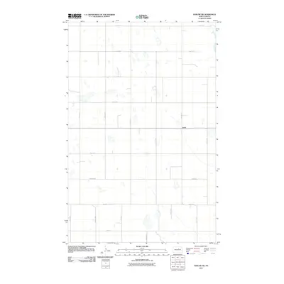
2011 Map of Harlow SW
USGS Topo · Published 2011About this map
Isabel anchors this portion of Benson County, situated within a vast grid of section roads that define the rural landscape of North Dakota. Surveyed in the early 21st century, the map reveals a terrain characterized by numerous depressions and ephemeral water bodies scattered across the prairie. The transportation network is strictly rectilinear, following the Public Land Survey System with thoroughfares such as Harrison Ave and 49th St NE providing access to the surrounding farmsteads. This document reflects the enduring agricultural organization of the region, where north-south avenues like 44th Ave NE intersect with east-west streets to create a predictable and functional layout for the scattered residents of the plains.
Find a feature on this map
17 named features on this map. Tap any name to fly to it.
Don’t see what you’re looking for? This feature index may not catch every label — zoom into the map to look around manually.
Map Details
Editions of this 2011 Harlow SW Map
This is the sole edition of this map. No revisions or reprints were ever made.
Other maps of this area

1941 · Selz
USGS Topo · 1:62,500

1943 · Maddock
USGS Topo · 1:62,500

1945 · Maddock
USGS Topo · 1:62,500

1951 · Selz NE
USGS Topo · 1:24,000

1951 · Maddock
USGS Topo · 1:24,000

1951 · Hesper
USGS Topo · 1:24,000

1952 · New Rockford
USGS Topo · 1:250,000

1953 · Devils Lake
USGS Topo · 1:250,000

1956 · New Rockford
USGS Topo · 1:250,000

1956 · Devils Lake
USGS Topo · 1:250,000