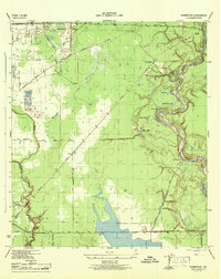
1944 Map of Harmaston
USGS Topo · Published 1944About this map
The San Jacinto River meanders through this portion of Harris County, creating a landscape of oxbow lakes and marshes including Bird Lake, McCormick Lake, and Silver Lake. During the mid-1940s, the region was undergoing significant infrastructure development, most notably the Water Supply Canal (Under Construction) which runs parallel to the river. This canal, supported by a Pumping Station, highlights the area's transition toward industrial utility.
Find a feature on this map
32 named features on this map. Tap any name to fly to it.
Don’t see what you’re looking for? This feature index may not catch every label — zoom into the map to look around manually.
Map Details
Editions of this 1944 Harmaston Map
This is the sole edition of this map. No revisions or reprints were ever made.
Other maps of this area

1916 · Burnett Bay
USGS Topo · 1:24,000

1916 · Crosby
USGS Topo · 1:24,000

1916 · Settegast
USGS Topo · 1:24,000

1916 · Fauna
USGS Topo · 1:24,000

1916 · Harmaston
USGS Topo · 1:24,000

1916 · Moonshine Hill
USGS Topo · 1:24,000

1916 · Huffman
USGS Topo · 1:24,000

1916 · Humble
USGS Topo · 1:24,000

1919 · Humble
USGS Topo · 1:31,680

1919 · Weeden
USGS Topo · 1:31,680