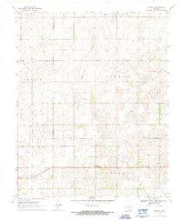
1970 Map of Harmon
USGS Topo · Published 1992About this map
Harmon sits at the center of this rural Oklahoma landscape, serving as a focal point for the surrounding plains of Ellis and Woodward counties. The 1970 field check reveals an economy defined by resource extraction, featuring a localized Oil Refinery, scattered Gas Wells, and a dedicated Oil Field situated along Turkey Creek. This intersection of agriculture and energy is marked by industrial infrastructure like the prominent Pipeline and a local Sandpit.
Find a feature on this map
20 named features on this map. Tap any name to fly to it.
Don’t see what you’re looking for? This feature index may not catch every label — zoom into the map to look around manually.
Map Details
Editions of this 1970 Harmon Map
2 editions found
Other maps of this area

1955 · Woodward
USGS Topo · 1:250,000

1958 · Woodward
USGS Topo · 1:250,000

1969 · Fargo SW
USGS Topo · 1:24,000

1969 · Vici NW
USGS Topo · 1:24,000

1969 · Woodward SW
USGS Topo · 1:24,000

1969 · Fargo SE
USGS Topo · 1:24,000

1970 · Harmon
USGS Topo · 1:24,000

1970 · Harmon SW
USGS Topo · 1:24,000
1970 · Harmon SE
USGS Topo · 1:24,000
1970 · Harmon NW
USGS Topo · 1:24,000