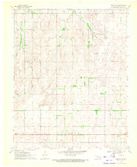
1970 Map of Harmon NW
USGS Topo · Published 1972About this map
The Old Indian Treaty Boundary slices across the landscape of Ellis County, marking a historic line of demarcation in this corner of Oklahoma. Surveyed around 1970, the area shows a distinct transition between agricultural grazing land and emerging energy extraction. Drainages like Wolf Creek and Little Wolf Creek wind through the township sections, punctuated by family-named landmarks such as Austin and Benton. This landscape is defined by its industrial footprint, featuring a significant Pipeline network and numerous scattered Gas Wells. For those studying the land use of the early 1970s, the map provides precise locations for various extractive sites, including several Gravel Pits and a Sandpit, alongside benchmark elevations like BM 2472 that reveal the Subtle topographic shifts of the High Plains.
Find a feature on this map
22 named features on this map. Tap any name to fly to it.
Don’t see what you’re looking for? This feature index may not catch every label — zoom into the map to look around manually.
Map Details
Editions of this 1970 Harmon NW Map
This is the sole edition of this map. No revisions or reprints were ever made.
Other maps of this area

1955 · Woodward
USGS Topo · 1:250,000

1958 · Woodward
USGS Topo · 1:250,000

1969 · Fargo SW
USGS Topo · 1:24,000

1969 · Gage
USGS Topo · 1:24,000

1969 · Fargo SE
USGS Topo · 1:24,000

1970 · Arnett
USGS Topo · 1:24,000

1970 · Harmon
USGS Topo · 1:24,000

1970 · Arnett SE
USGS Topo · 1:24,000

1970 · Harmon SW
USGS Topo · 1:24,000
1970 · Harmon SE
USGS Topo · 1:24,000